Observation de la Terre depuis l'espace
Le forum de la conquête spatiale :: Actualité spatiale :: Exploration du système solaire, et au delà ...
Page 29 sur 32
Page 29 sur 32 •  1 ... 16 ... 28, 29, 30, 31, 32

 Re: Observation de la Terre depuis l'espace
 Ven 26 Aoû 2022 - 23:43
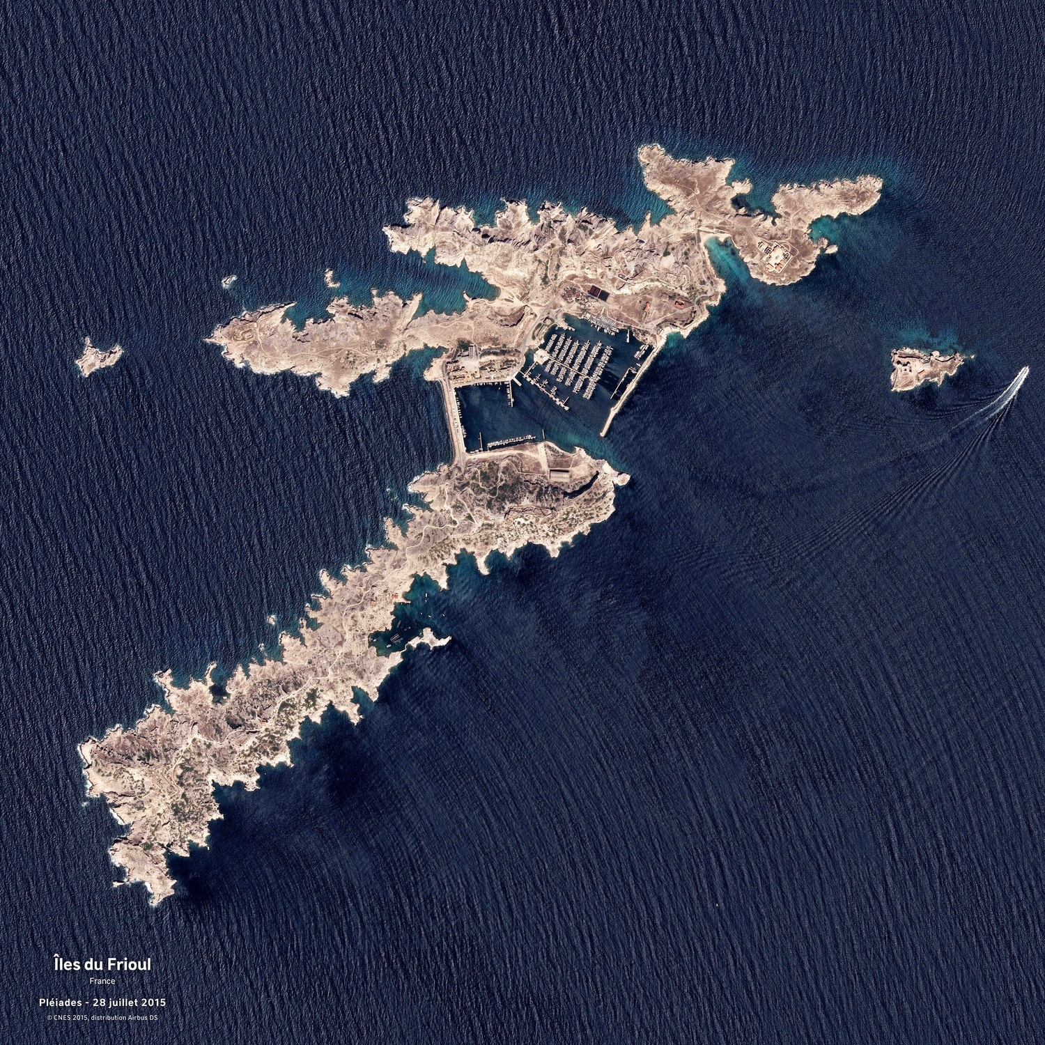
Les îles du Frioul, vues par un satellite Pléiades le 28 juillet 2015 :
David L.- Modérateur

- Messages : 32180
Inscrit le : 16/08/2009

Re: Observation de la Terre depuis l'espace
Sam 27 Aoû 2022 - 8:47
J'ai eu toute ma jeunesse une vue, depuis ma chambre, sur ces îles, Chateau d'If compris. J'habitais au Vallon des Auffes à Marseille de 1942 à 1962 !

Astro-notes- Messages : 16958
Inscrit le : 12/04/2006
Age : 81
Localisation : Corse du Sud -

Re: Observation de la Terre depuis l'espace
Sam 27 Aoû 2022 - 21:47
La région de Qikiqtaaluk, dans le Nunavut, vue par un satellite Sentinel-2 le 17 août 2022 :
David L.- Modérateur
- Messages : 32180
Inscrit le : 16/08/2009
Age : 50
Localisation : Troisième planète
Re: Observation de la Terre depuis l'espace
Sam 27 Aoû 2022 - 23:11
Merci pour toutes ses photos qui nous montrent que la terre vu de l’espace est magnifique est fragile.
Le Toulonnais- Messages : 268
Inscrit le : 23/09/2007
Age : 41
Localisation : Toulon (83 VAR) France
Re: Observation de la Terre depuis l'espace
Sam 17 Sep 2022 - 18:35
La tempête tropicale Fiona au-dessus des Antilles, vue par le satellite GOES-16 dans l'infrarouge, le 17 septembre 2022 à 4h05 puis 6h05 GMT :
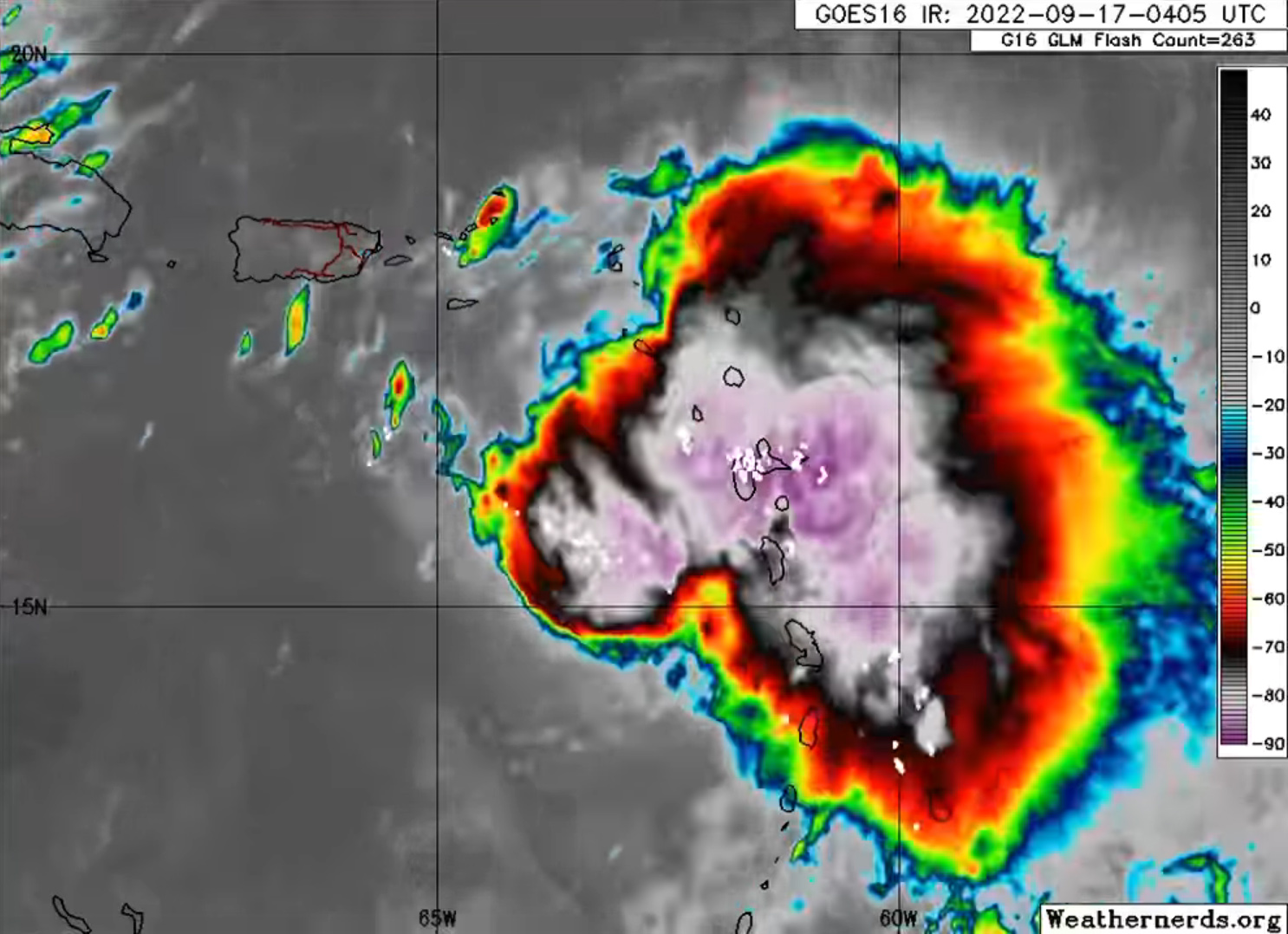
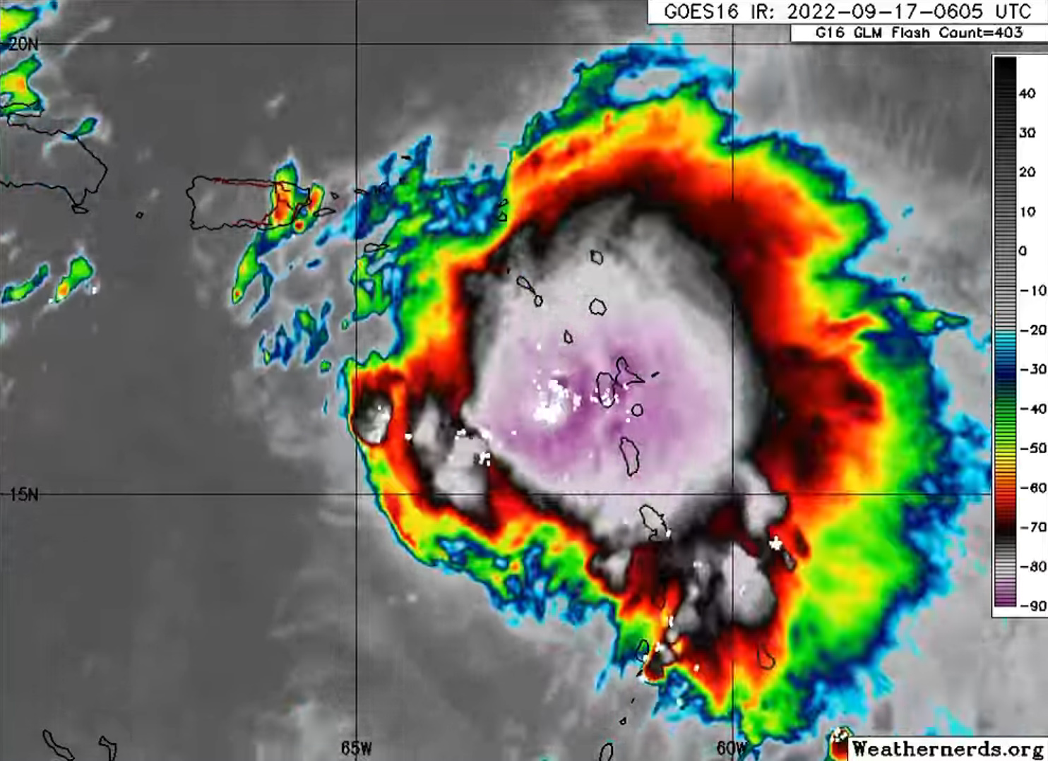
La température mesurée au sommet des nuages est de -85°C.
La température mesurée au sommet des nuages est de -85°C.
David L.- Modérateur
- Messages : 32180
Inscrit le : 16/08/2009
Age : 50
Localisation : Troisième planète
Re: Observation de la Terre depuis l'espace
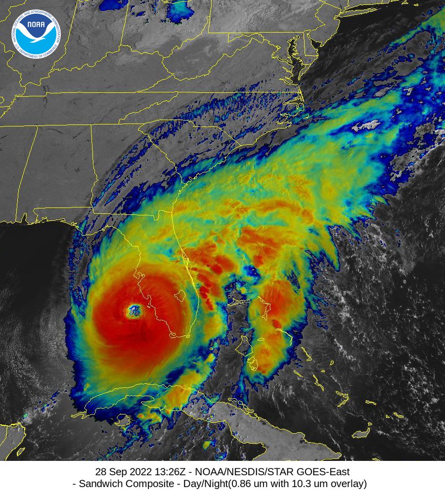
Mer 28 Sep 2022 - 17:50
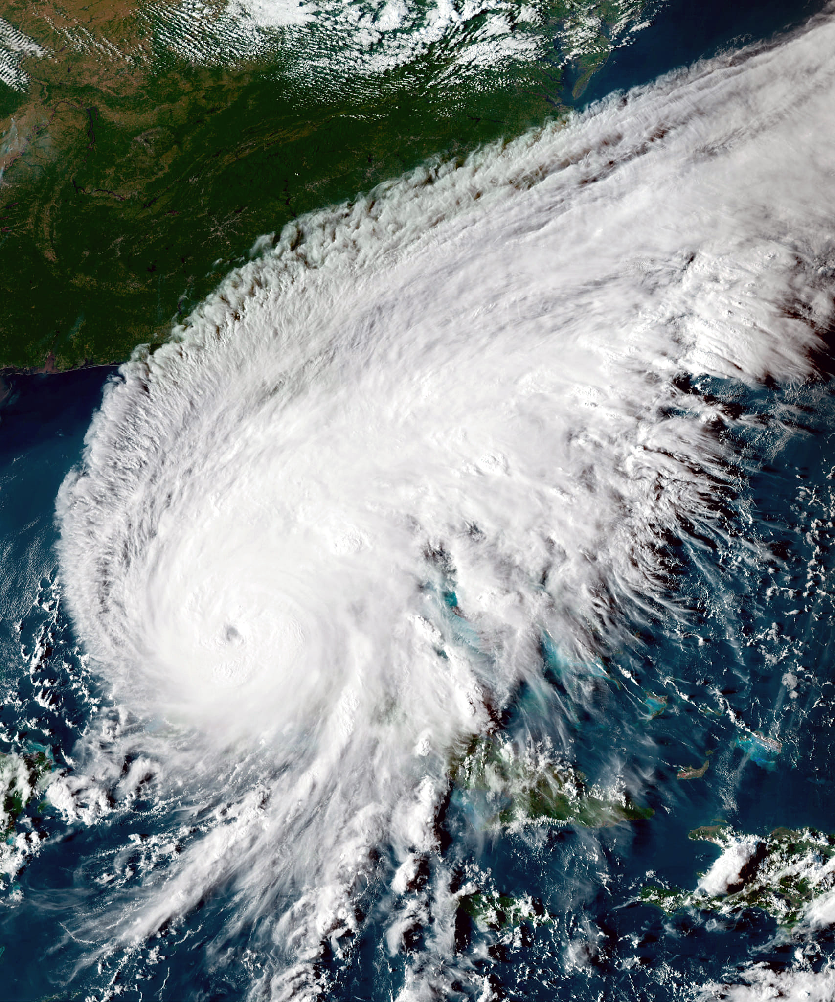
Le cyclone Ian, vu aujourd'hui par le satellite GOES-East :
David L.- Modérateur
- Messages : 32180
Inscrit le : 16/08/2009
Age : 50
Localisation : Troisième planète
Re: Observation de la Terre depuis l'espace
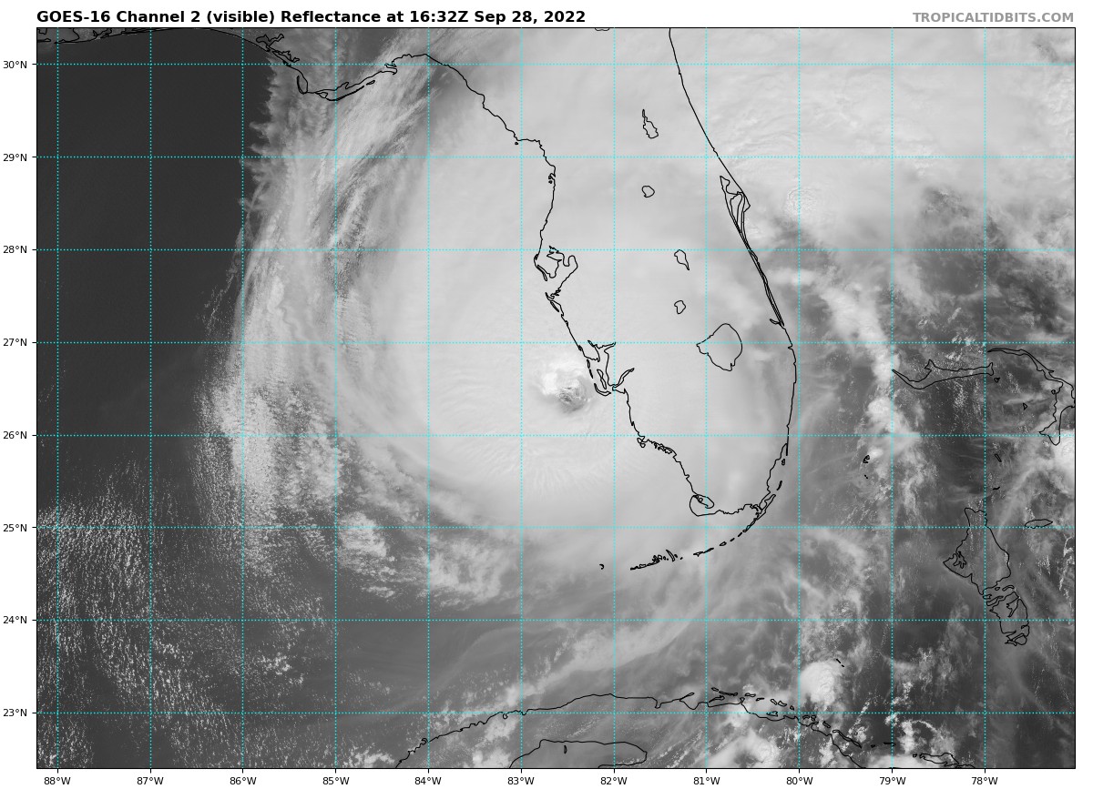
Mer 28 Sep 2022 - 20:09
Ian, à nouveau vu le 28 septembre 2022, mais cette fois en lumière visible :
David L.- Modérateur
- Messages : 32180
Inscrit le : 16/08/2009
Age : 50
Localisation : Troisième planète
Re: Observation de la Terre depuis l'espace
Mer 28 Sep 2022 - 20:16
L'oeil de Ian, vu cet après-midi par GOES-16, approche de la Floride :
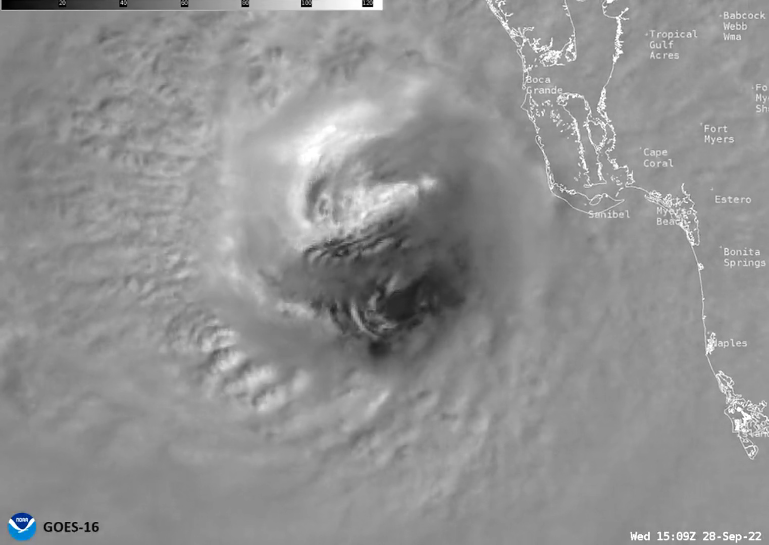
David L.- Modérateur
- Messages : 32180
Inscrit le : 16/08/2009
Age : 50
Localisation : Troisième planète
Re: Observation de la Terre depuis l'espace
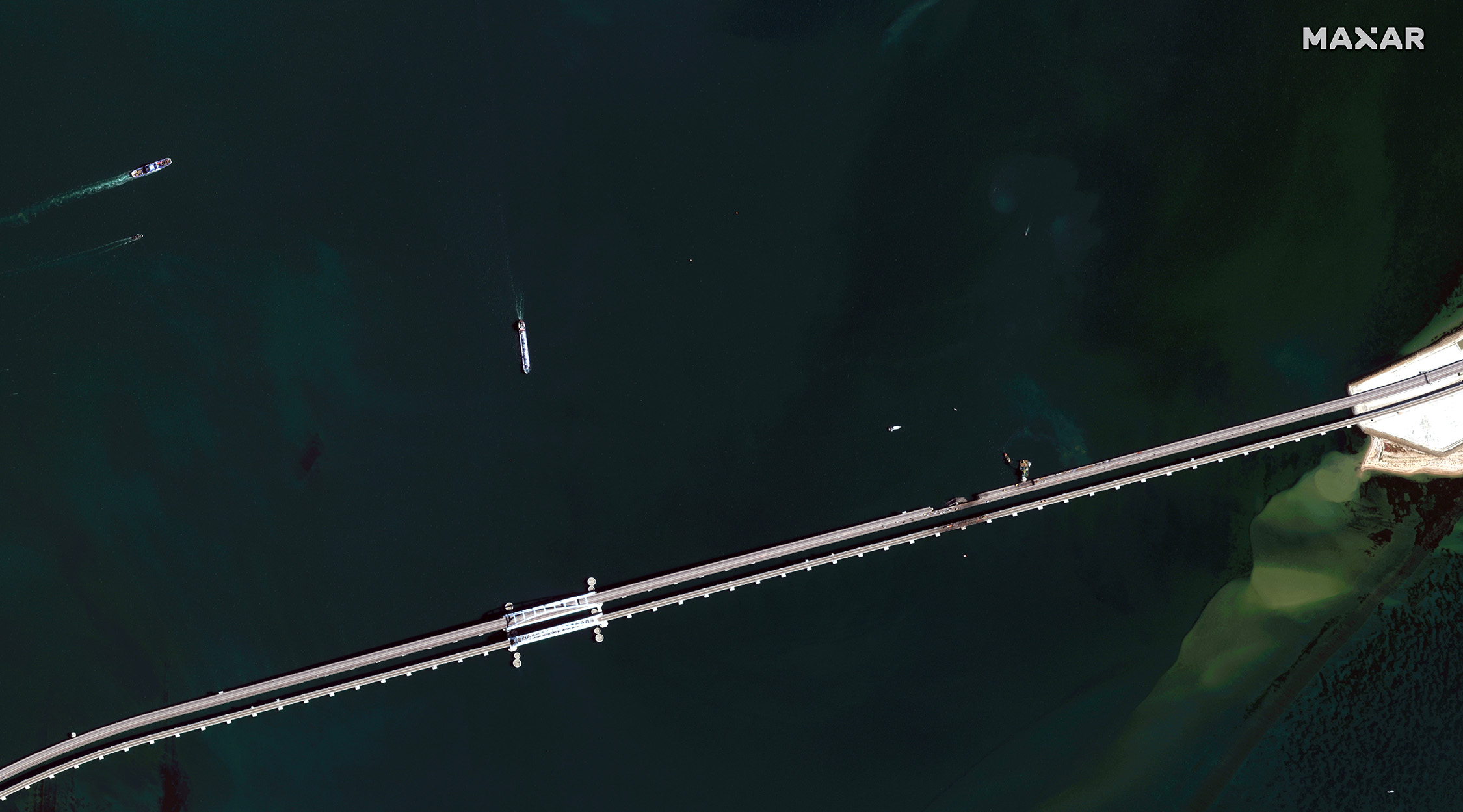
Sam 8 Oct 2022 - 19:49
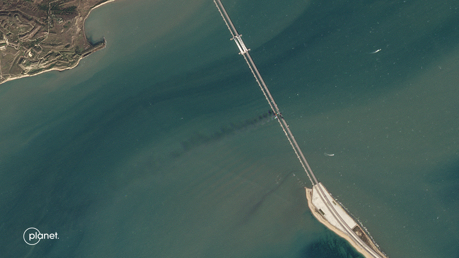
Le pont du détroit de Kerch, vu les 7 et 8 octobre 2022 par des satellites de la société Planet :
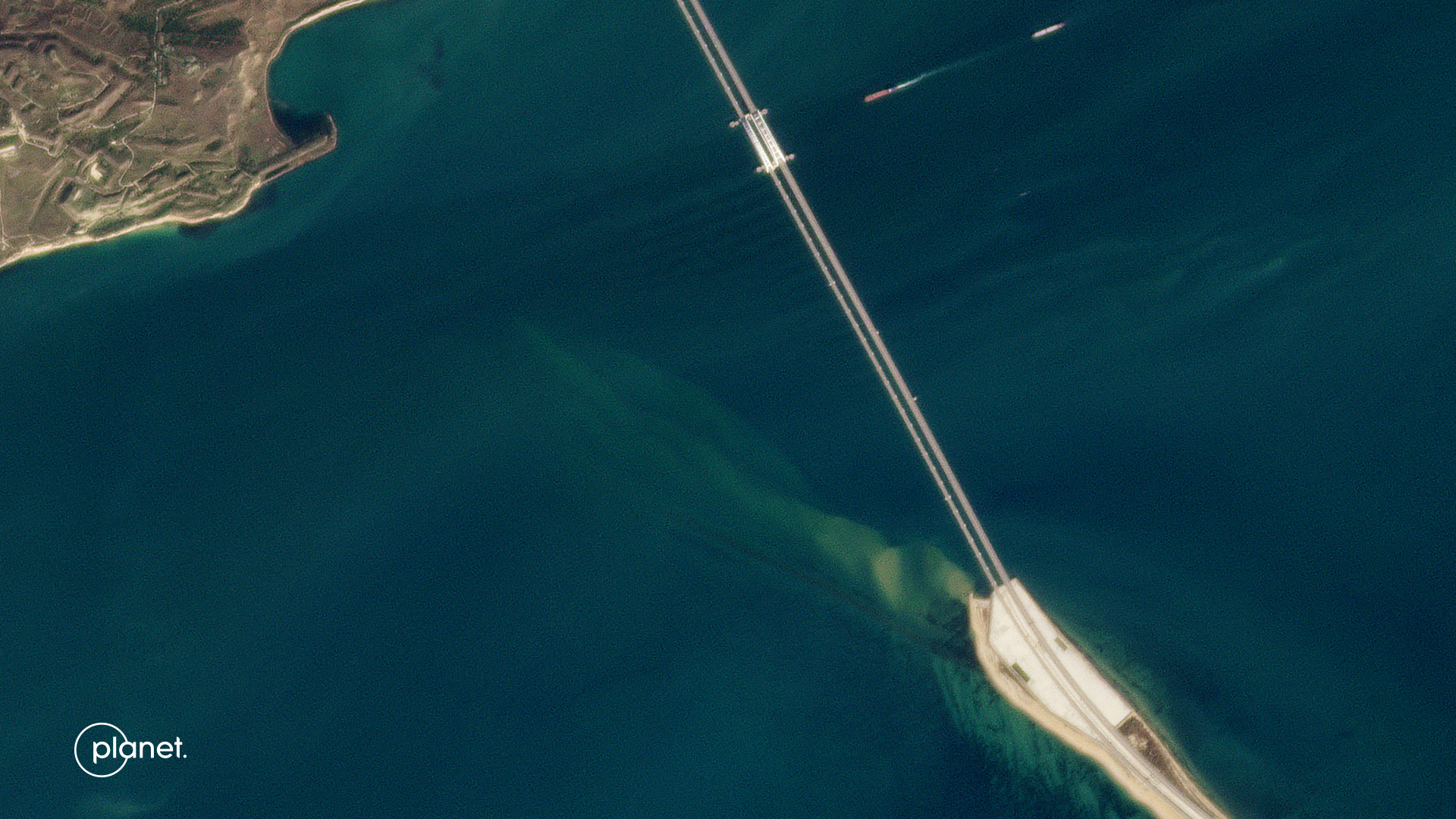
David L.- Modérateur
- Messages : 32180
Inscrit le : 16/08/2009
Age : 50
Localisation : Troisième planète
Re: Observation de la Terre depuis l'espace
Sam 8 Oct 2022 - 20:57
Depuis l'ISS le 28 mai dernier :


Loulou- Messages : 1164
Inscrit le : 08/10/2007
Age : 73
Localisation : Saint Cyprien
Re: Observation de la Terre depuis l'espace
Sam 8 Oct 2022 - 21:39
Le nord de l'Italie, vu par un satellite Sentinel-3 le 6 octobre 2022 :
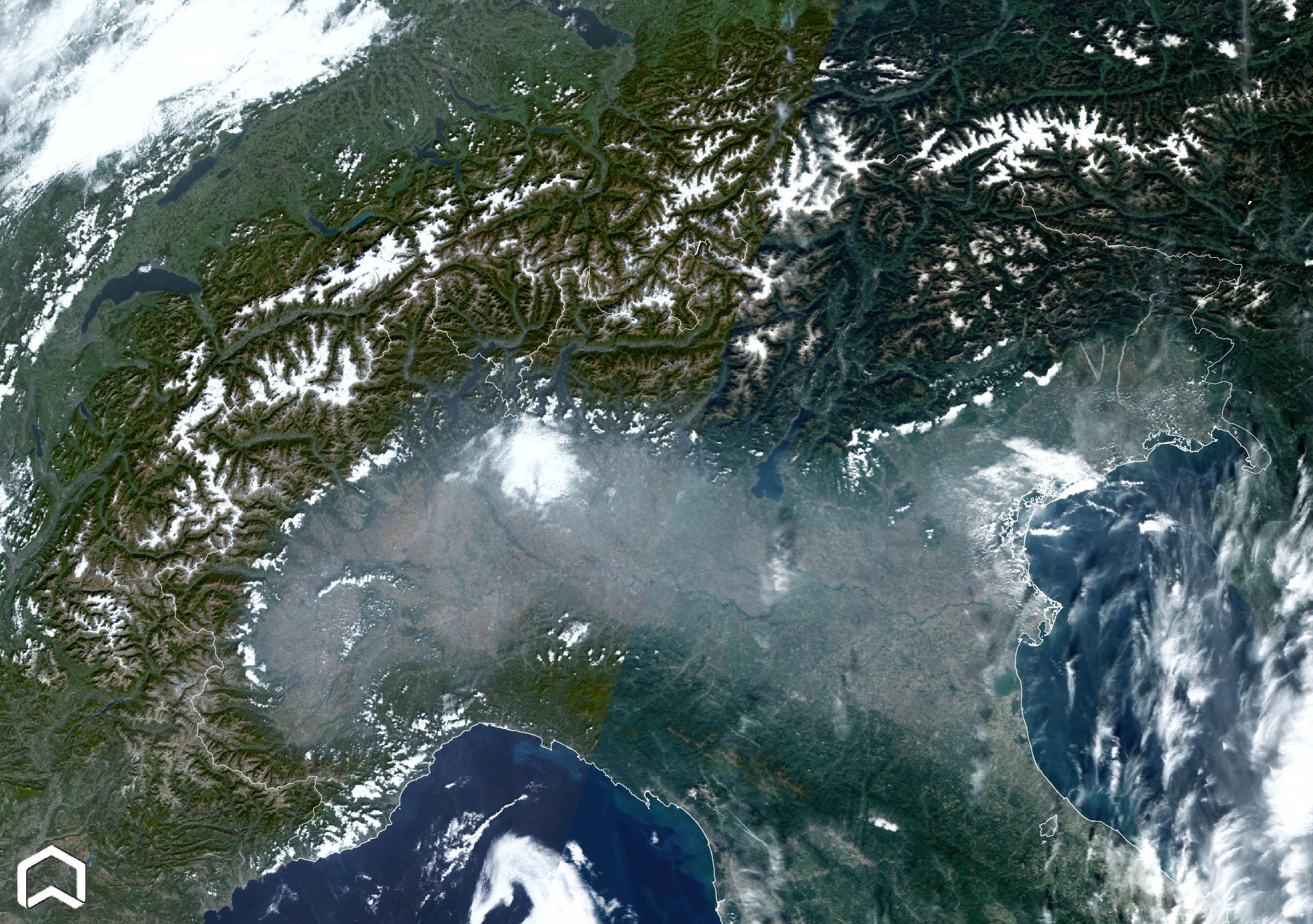
La pollution de l'air est visible dans les plaines.
La pollution de l'air est visible dans les plaines.
David L.- Modérateur
- Messages : 32180
Inscrit le : 16/08/2009
Age : 50
Localisation : Troisième planète
Re: Observation de la Terre depuis l'espace
Dim 9 Oct 2022 - 23:12
L'incendie des citernes du train du pont du détroit de Kertch a été observée par Météosat 9 :
https://twitter.com/ar_etsch/status/1578733452731756546
https://twitter.com/ar_etsch/status/1578733452731756546
David L.- Modérateur
- Messages : 32180
Inscrit le : 16/08/2009
Age : 50
Localisation : Troisième planète
Re: Observation de la Terre depuis l'espace
Sam 15 Oct 2022 - 16:22
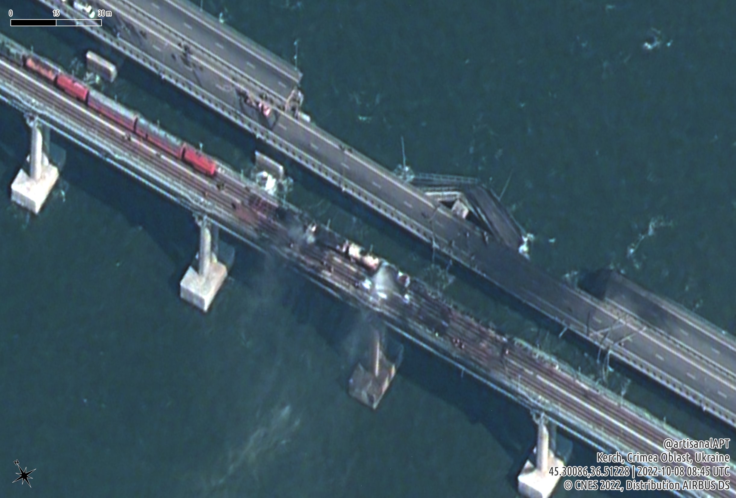
Le pont du détroit de Kertch, vu par un satellite Pléiades Neo le 8 octobre 2022 :
David L.- Modérateur
- Messages : 32180
Inscrit le : 16/08/2009
Age : 50
Localisation : Troisième planète
Re: Observation de la Terre depuis l'espace
Mar 18 Oct 2022 - 21:37
Images diffusées par Maxar Technologies le 13 octobre 2022 du pont du détroit de Kertch :
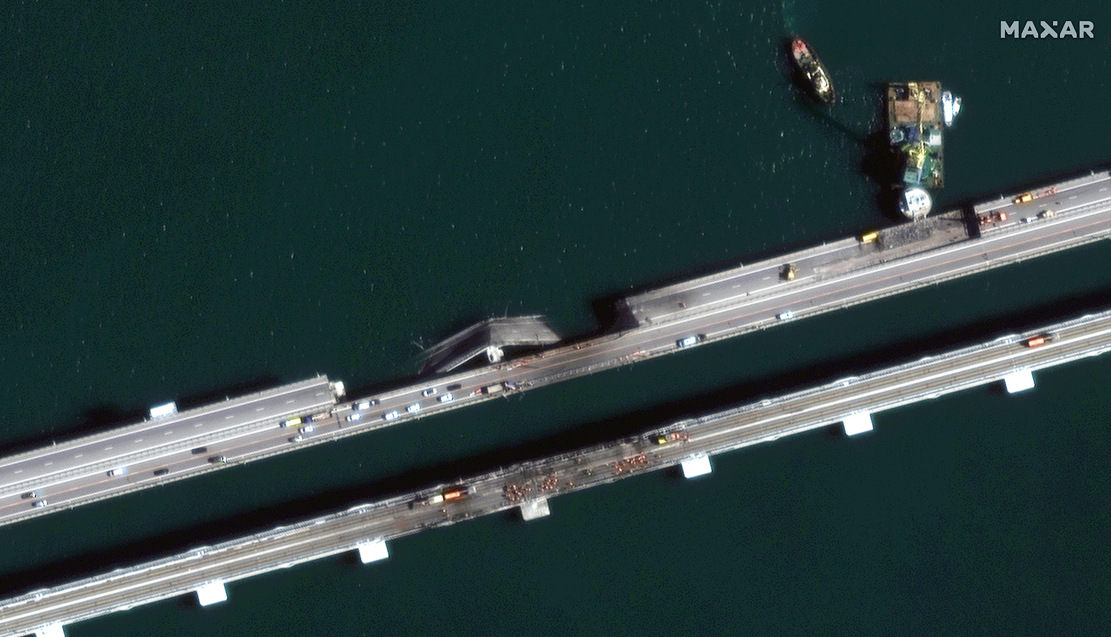
Par rapport aux images postées ci-dessus, le train de wagons citernes semble déjà avoir déjà été évacué.
Par rapport aux images postées ci-dessus, le train de wagons citernes semble déjà avoir déjà été évacué.
David L.- Modérateur
- Messages : 32180
Inscrit le : 16/08/2009
Age : 50
Localisation : Troisième planète
Re: Observation de la Terre depuis l'espace
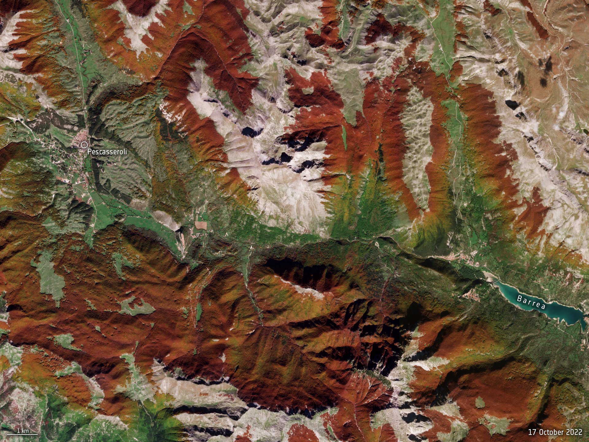
Mar 18 Oct 2022 - 23:40
Les couleurs de l'automne dans les Apennins, en Italie, vues le 17 octobre 2022 par un satellite Sentinel-2 :
https://www.esa.int/ESA_Multimedia/Images/2022/10/Autumn_foliage
https://www.esa.int/ESA_Multimedia/Images/2022/10/Autumn_foliage
David L.- Modérateur
- Messages : 32180
Inscrit le : 16/08/2009
Age : 50
Localisation : Troisième planète
Re: Observation de la Terre depuis l'espace
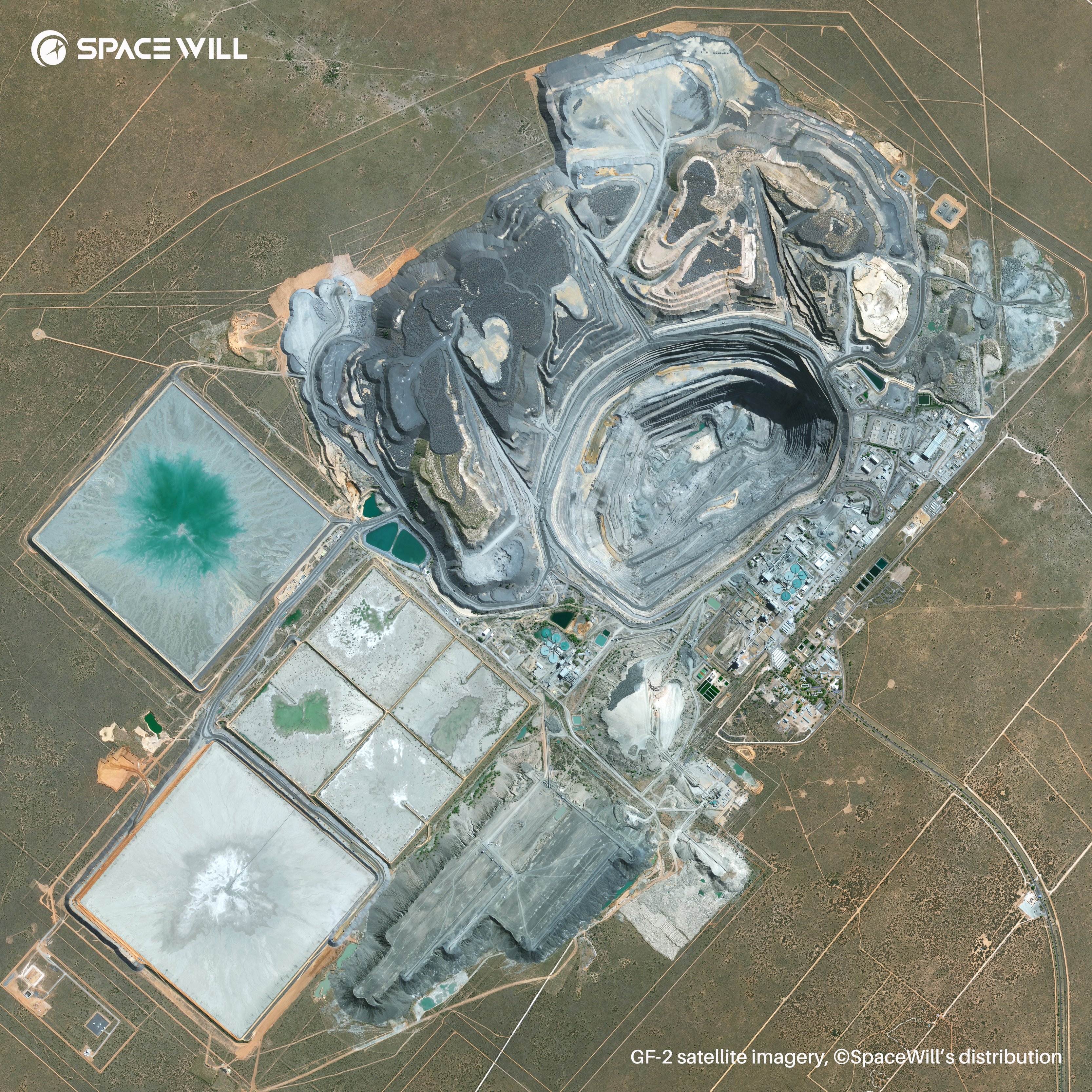
Mer 19 Oct 2022 - 11:31
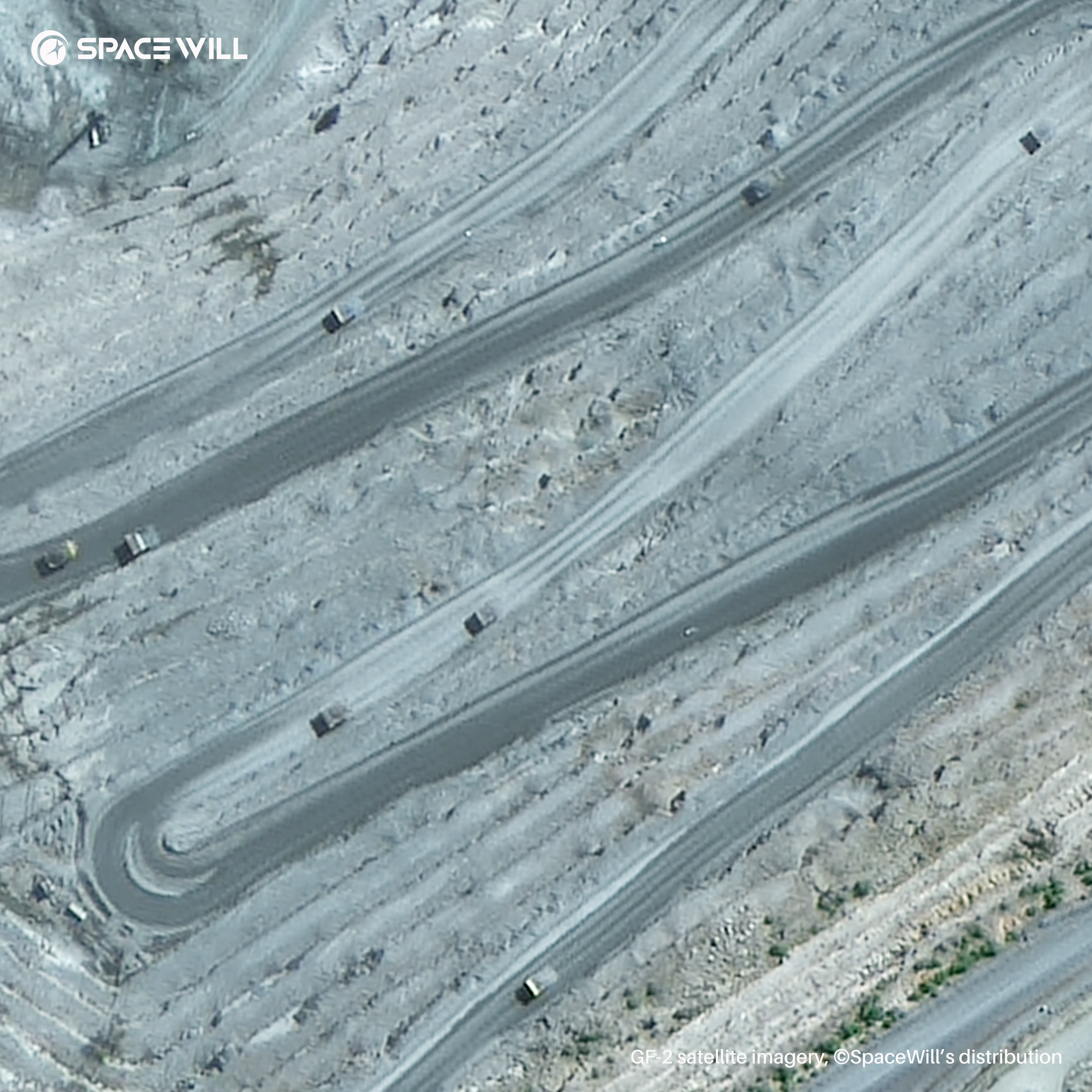
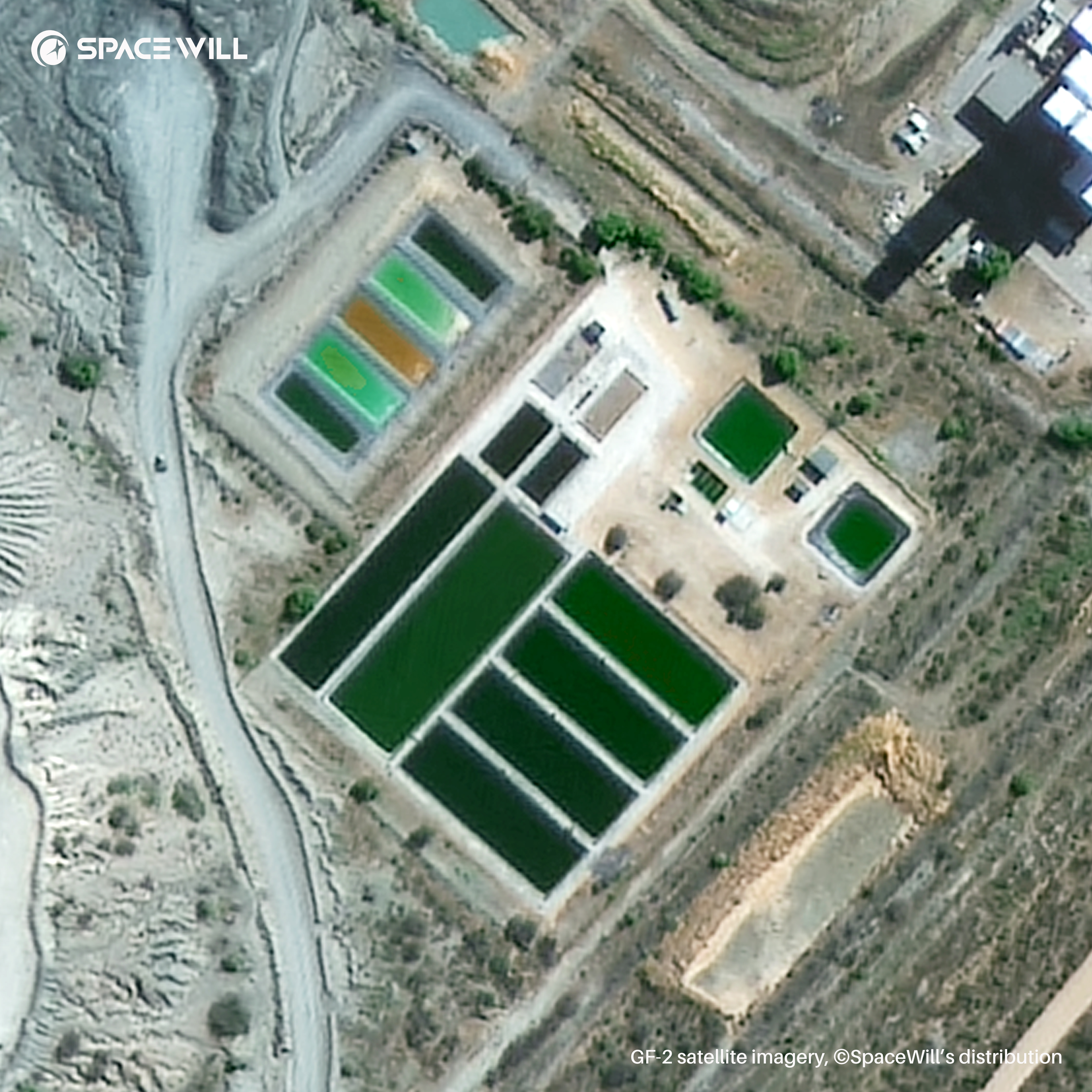
La mine de diamants à ciel ouvert de Jwaneng, au Botswana, vue par le satellite Gaofen-2 :
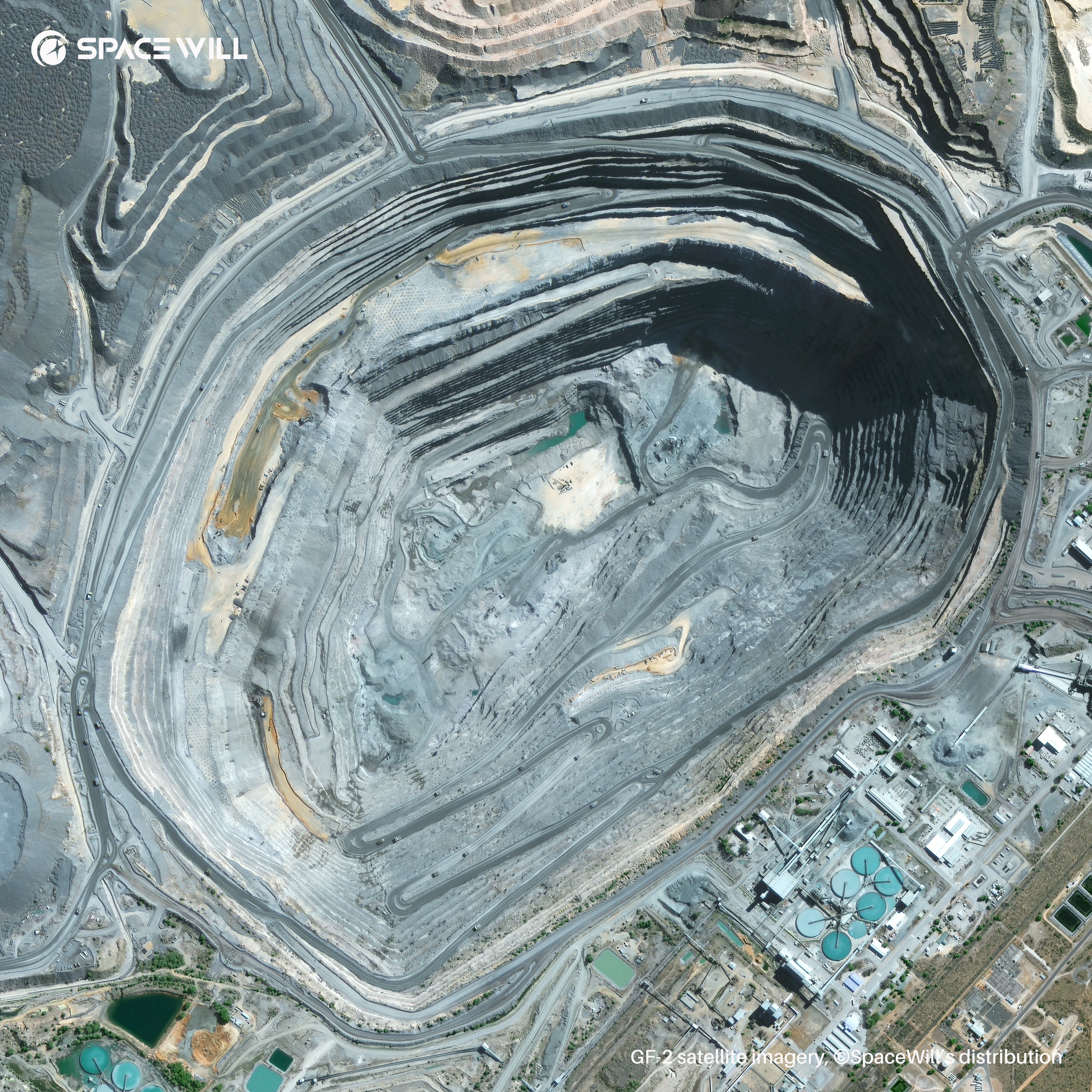
https://fr.wikipedia.org/wiki/Mine_de_Jwaneng
https://fr.wikipedia.org/wiki/Mine_de_Jwaneng
David L.- Modérateur
- Messages : 32180
Inscrit le : 16/08/2009
Age : 50
Localisation : Troisième planète
Re: Observation de la Terre depuis l'espace
Jeu 27 Oct 2022 - 17:37
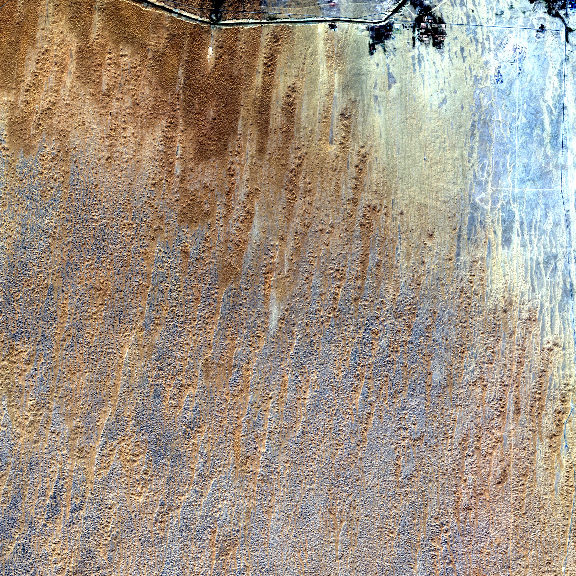
Une partie de la région de Souss-Massa (29,3°N, 8,4°O), au Maroc, vue le 13 octobre 2022 par un satellite Sentinel-2 :
https://fr.wikipedia.org/wiki/Souss-Massa
https://fr.wikipedia.org/wiki/Souss-Massa
David L.- Modérateur
- Messages : 32180
Inscrit le : 16/08/2009
Age : 50
Localisation : Troisième planète
Re: Observation de la Terre depuis l'espace
Jeu 27 Oct 2022 - 17:59
Une partie de la région de Lebap (41,0°N, 61,3°E), au Turkmenistan, vue le 15 octobre 2022 par un satellite Sentinel-2 :
https://fr.wikipedia.org/wiki/Lebap
https://fr.wikipedia.org/wiki/Lebap
David L.- Modérateur
- Messages : 32180
Inscrit le : 16/08/2009
Age : 50
Localisation : Troisième planète
Re: Observation de la Terre depuis l'espace
Dim 30 Oct 2022 - 0:25
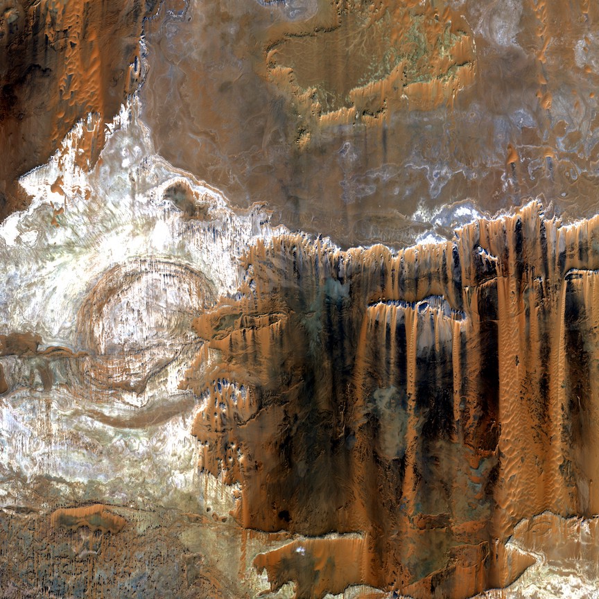
Une partie du gouvernorat de la Nouvelle-Vallée, en Egypte, par 23.0°N et 30.6°E, vue par un satellite Sentinel-2 le 25 octobre 2022 :
David L.- Modérateur
- Messages : 32180
Inscrit le : 16/08/2009
Age : 50
Localisation : Troisième planète
Re: Observation de la Terre depuis l'espace
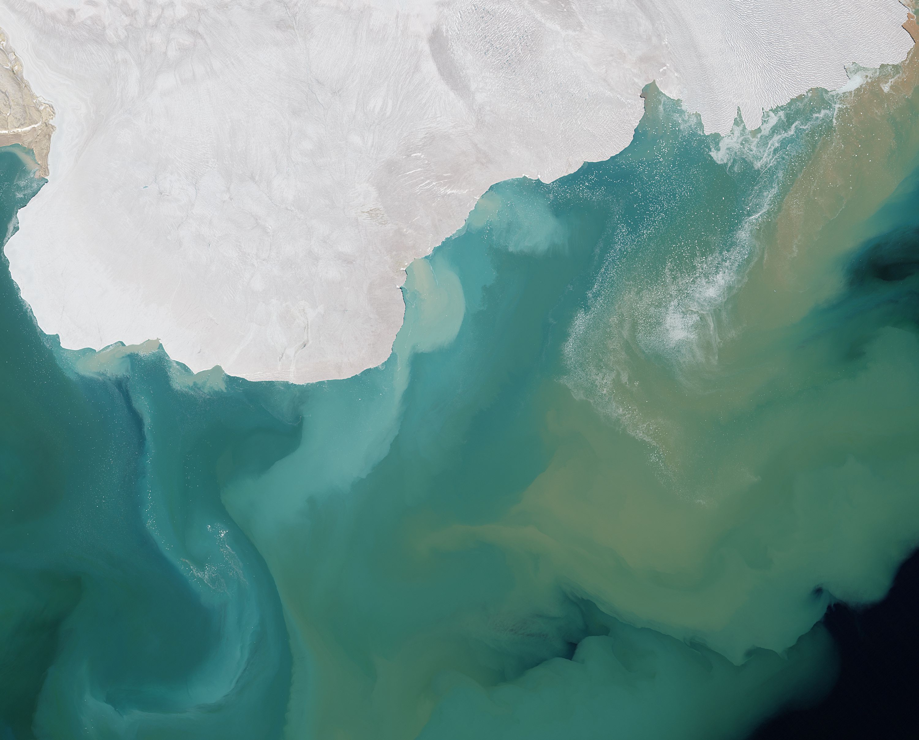
Lun 31 Oct 2022 - 18:46
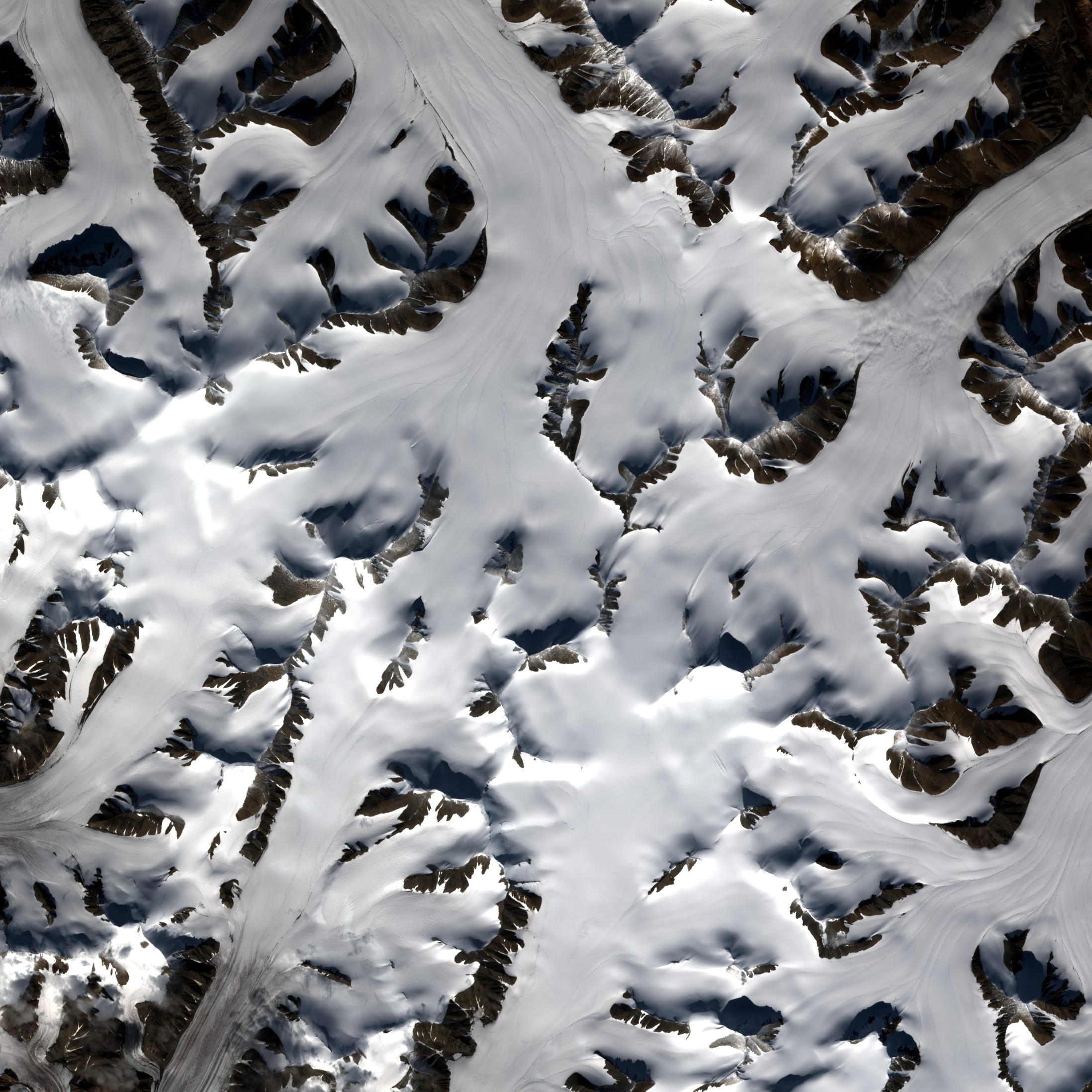
L'état de la banquise Antarctique dans la mer de Weddell, vu le 25 octobre 2022 par un satellite Sentinel-2 avec une résolution de 10 m :
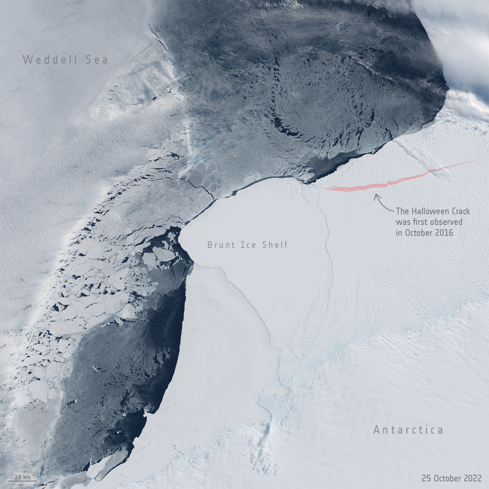
https://www.esa.int/ESA_Multimedia/Images/2022/10/Halloween_Crack_for_Halloween
Halloween Crack for Halloween
31/10/2022
Marking Halloween, we bring you this recent Copernicus Sentinel-2 image of the Halloween Crack in Antarctica.
First spotted on 31 October 2016, the Halloween Crack runs from an area known as McDonald Ice Rumples – which is where the underside of the floating ice sheet is grounded on the shallow seabed. This pinning point slows the flow of ice and fractures the ice surface.
The Halloween Crack, which is currently stable, runs adjacent the more precarious tip of Brunt Ice Shelf. This tip of the shelf is hanging by a thread – now only held in place by a narrow strip of ice around 600 m long at the northern end of the long chasm cutting through the western and remaining eastern part of the ice shelf. If and when this potential rupture point finally gives way, it is expected to spawn a huge iceberg about 1750 square kilometres, which is over five times bigger than the size of Malta.
Ice shelves float so when they calve icebergs the bergs do not actually add to sea-level rise. However, ice shelves act as a brake on how fast the glaciers on the land flow to the sea. Owing to climate change, Antarctica’s ice shelves are weakening, leading to greater risks of more land ice ending up in the oceans and thereby adding to sea-level rise, something arguably more frightening than Halloween.
Routine monitoring by satellites with different observing capabilities offer unprecedented views of events happening in remote regions like Antarctica, and how ice shelves are coping in response to changes in ice dynamics, air and ocean temperatures.
Zoom in to see this Copernicus Sentinel-2 image at it full 10 m resolution. The image was captured on 25 October 2022.
David L.- Modérateur
- Messages : 32180
Inscrit le : 16/08/2009
Age : 50
Localisation : Troisième planète
Re: Observation de la Terre depuis l'espace
Lun 31 Oct 2022 - 19:51
L'archipel du Svalbard, vu le 21 août 2022 par un satellite Sentinel-2 :
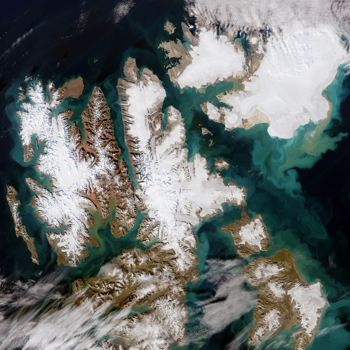
https://www.esa.int/Applications/Observing_the_Earth/Copernicus/Earth_from_Space_Svalbard
Earth from Space: Svalbard
28/10/2022
Extremely high temperatures recorded this summer caused record melting across Svalbard – one of the fastest warming places on the planet. The Copernicus Sentinel-2 mission captured this rare, cloud-free acquisition of the Norwegian archipelago in August 2022.
Located north of mainland Europe, Svalbard is around midway between the northern coast of Norway and the North Pole. The archipelago, which spans around 62 700 sq km, is composed of nine main islands. The largest is Spitsbergen, visible here in the far-left, followed by Nordaustlandet in the top-right and Edgeøya in the bottom-right.
Spitsbergen, which is around the same size as Switzerland, has a mountainous terrain with most of the island covered with glaciers. Its highest point is Mount Newton, around 1717 m, in the northeast. The island is deeply indented by fjords. The longest fjord of the archipelago is Wijdefjorden and it is 108 km long. Opening on Spitsbergen's north coast, it runs roughly southwards into the interior, separating Andrée Land in the west from Margaretas Land in the east.
Also on Spitsbergen lies the Svalbard Satellite Station – SvalSat for short – which can be seen in the image peeking through the clouds. The ground station, which is operated by Kongsberg Satellite Services (KSAT), has worked with a range of Earth observation missions including Aeolus, Swarm, CryoSat and all Copernicus Sentinel satellites.
The station is also important to the Galileo satellite navigation system – Europe’s global navigation satellite system. Its location makes it one of the most remote Galileo ground stations in the world.
This summer saw exceptionally warm air temperatures in Svalbard according to the Norwegian Meteorological Institute. An average of 7.4 °C was recorded in June, July and August compared to the 5.5°C average recorded during the 1991-2020 period. The heatwave caused exceptional levels of melting, which ultimately contributes to sea level rise.
The image, captured on 21 August, shows the colourful and large sediment discharges in the Arctic Ocean. This is likely due to sediments that eroded by the flow of ice and then carried by meltwater into the Arctic Ocean. There is also some phytoplankton present in the waters, as seen in the far right, which colours the water turquoise and green.
Data acquired by the Copernicus Sentinel satellites are used to detect changes in Earth's surface in great detail and monitor the effects of climate change on remote environments such as the Arctic region.
This image is also featured on the Earth from Space video programme.
David L.- Modérateur
- Messages : 32180
Inscrit le : 16/08/2009
Age : 50
Localisation : Troisième planète
Re: Observation de la Terre depuis l'espace
Jeu 3 Nov 2022 - 0:46
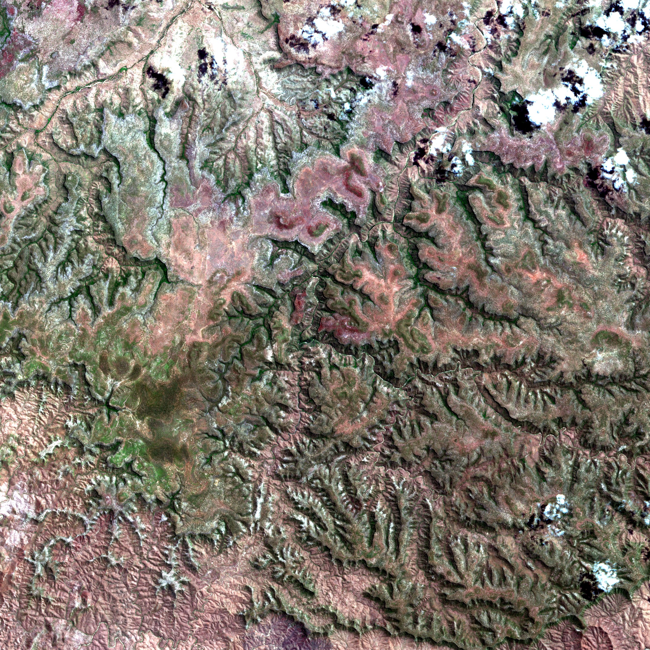
Une partie de la région du Queensland, en Australie, par 15,8°S et 144,3°E, vue par un satellite Sentinel-2 le 28 septembre 2022 :
David L.- Modérateur
- Messages : 32180
Inscrit le : 16/08/2009
Age : 50
Localisation : Troisième planète
Re: Observation de la Terre depuis l'espace
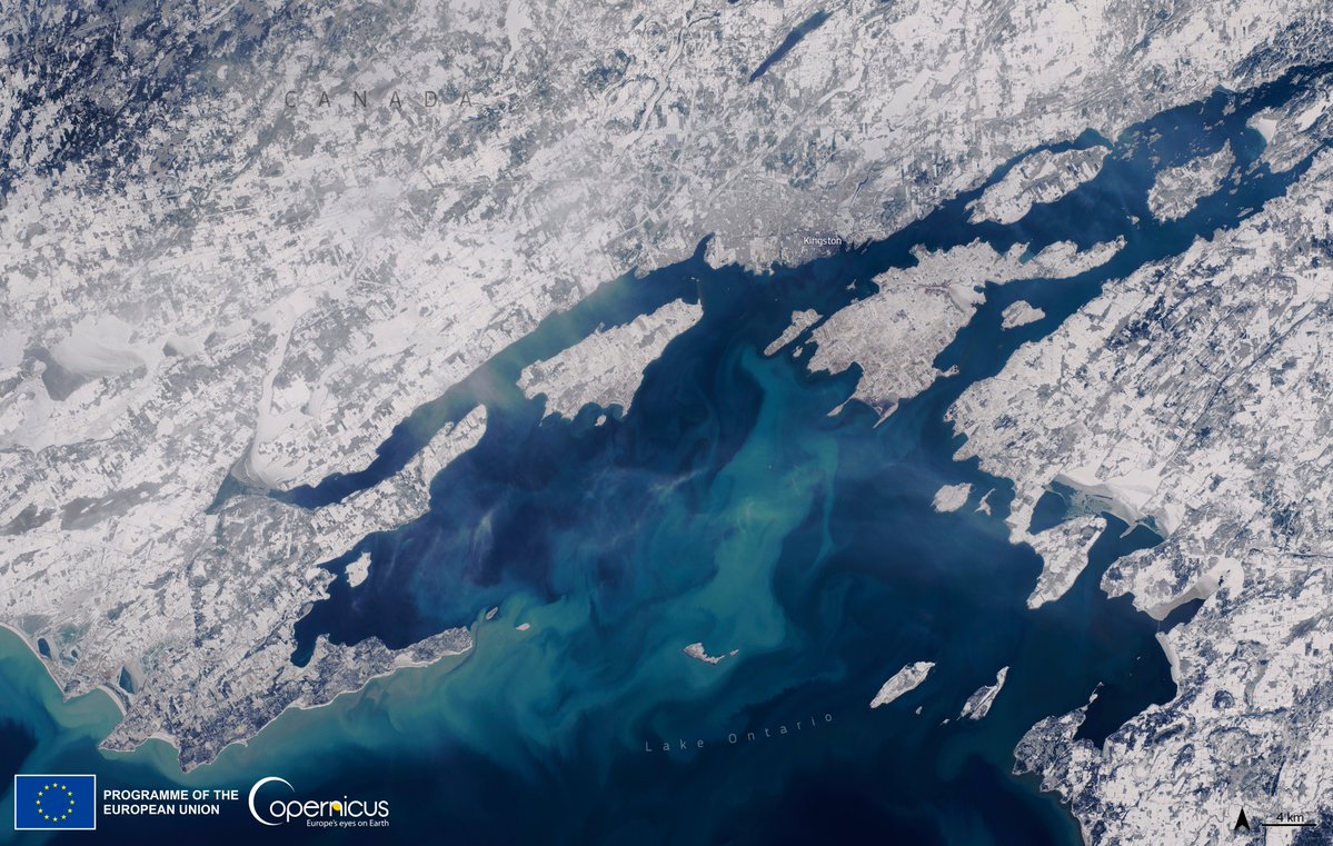
Sam 31 Déc 2022 - 23:46
La ville de Kingston, au Canada, et une partie du lac Ontario, vus par un satellite Sentinel-2 le 29 décembre 2022 :
David L.- Modérateur
- Messages : 32180
Inscrit le : 16/08/2009
Age : 50
Localisation : Troisième planète
Re: Observation de la Terre depuis l'espace
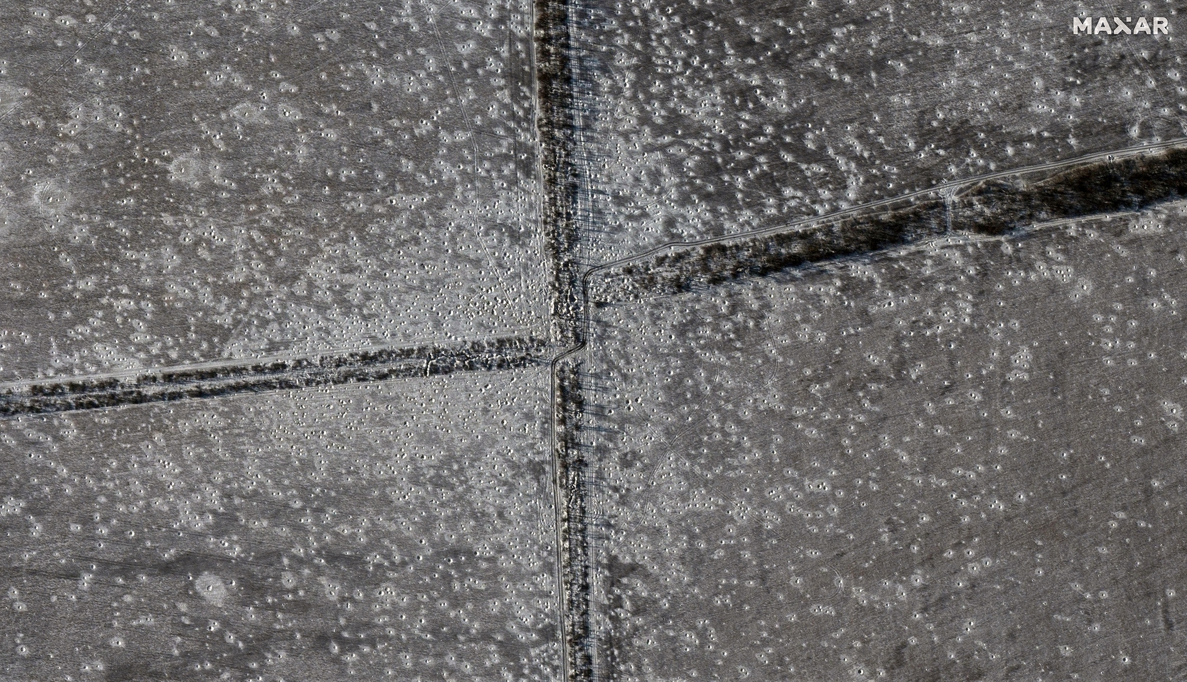
Mer 11 Jan 2023 - 23:30
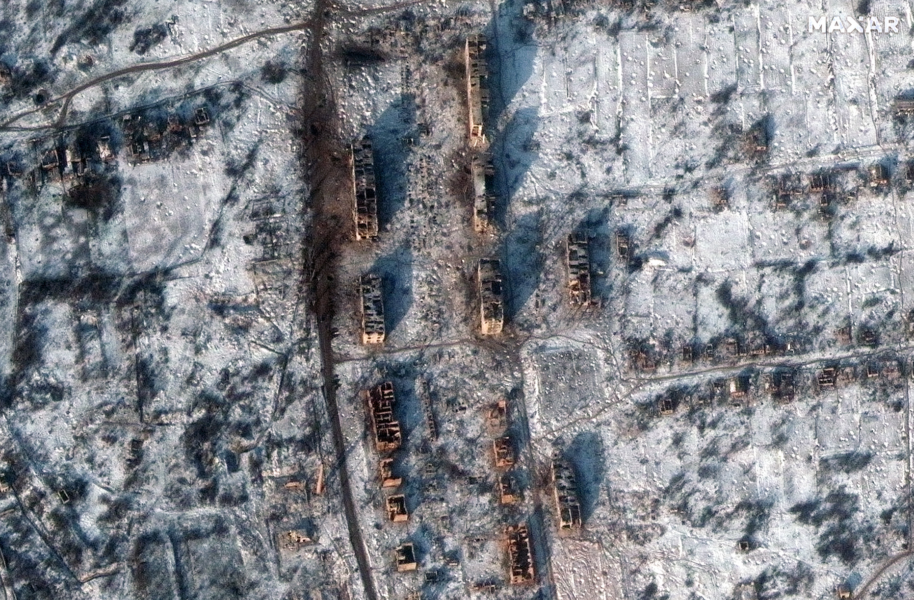
Cratères près de Bakhmout (Ukraine) le 7 janvier 2023, vus par un satellite de la société Maxar :
David L.- Modérateur
- Messages : 32180
Inscrit le : 16/08/2009
Age : 50
Localisation : Troisième planète
Re: Observation de la Terre depuis l'espace
Mer 11 Jan 2023 - 23:43
La ville de Soledar (Ukraine) le 1er août 2022 :
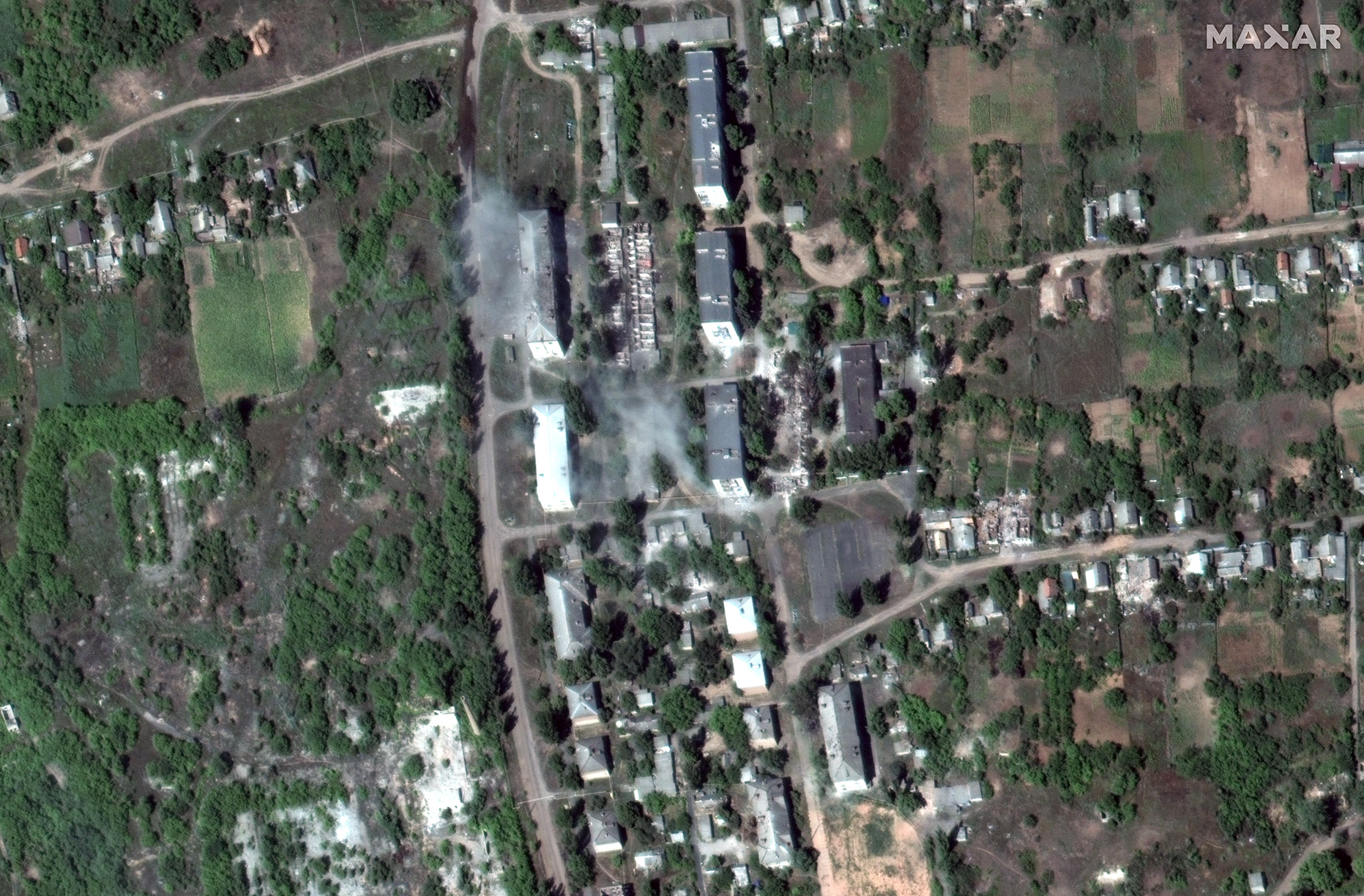
... et le 10 janvier 2023, vue par un ou des satellites de la société Maxar :
... et le 10 janvier 2023, vue par un ou des satellites de la société Maxar :
David L.- Modérateur
- Messages : 32180
Inscrit le : 16/08/2009
Age : 50
Localisation : Troisième planète
Re: Observation de la Terre depuis l'espace
Jeu 19 Jan 2023 - 20:14
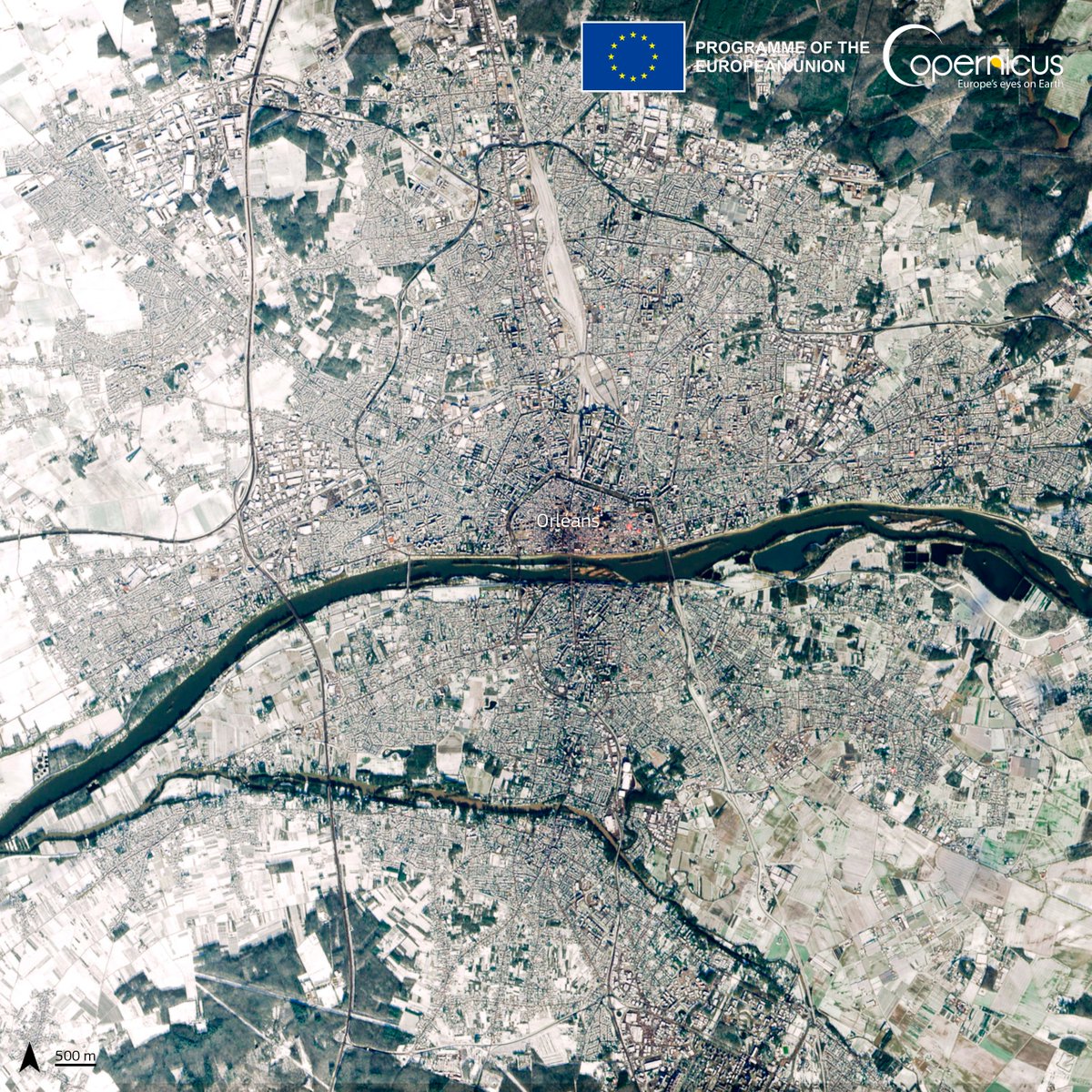
La ville d'Orléans enneigée, vue par un satellite Sentinel-2 le 18 janvier 2023 :
David L.- Modérateur
- Messages : 32180
Inscrit le : 16/08/2009
Age : 50
Localisation : Troisième planète
Page 29 sur 32 • 1 ... 16 ... 28, 29, 30, 31, 32

 Sujets similaires
» Observation de la Terre depuis l'espace - Cyclones
» Observation de Neptune depuis la Terre
» Observation de Mars depuis la Terre
» Observation de Saturne depuis la Terre
» Observation de la Lune depuis la Terre
» Observation de Neptune depuis la Terre
» Observation de Mars depuis la Terre
» Observation de Saturne depuis la Terre
» Observation de la Lune depuis la Terre
Le forum de la conquête spatiale :: Actualité spatiale :: Exploration du système solaire, et au delà ...
Page 29 sur 32
Permission de ce forum:
Vous ne pouvez pas répondre aux sujets dans ce forum